Maptek introduces GeoSpatial Manager

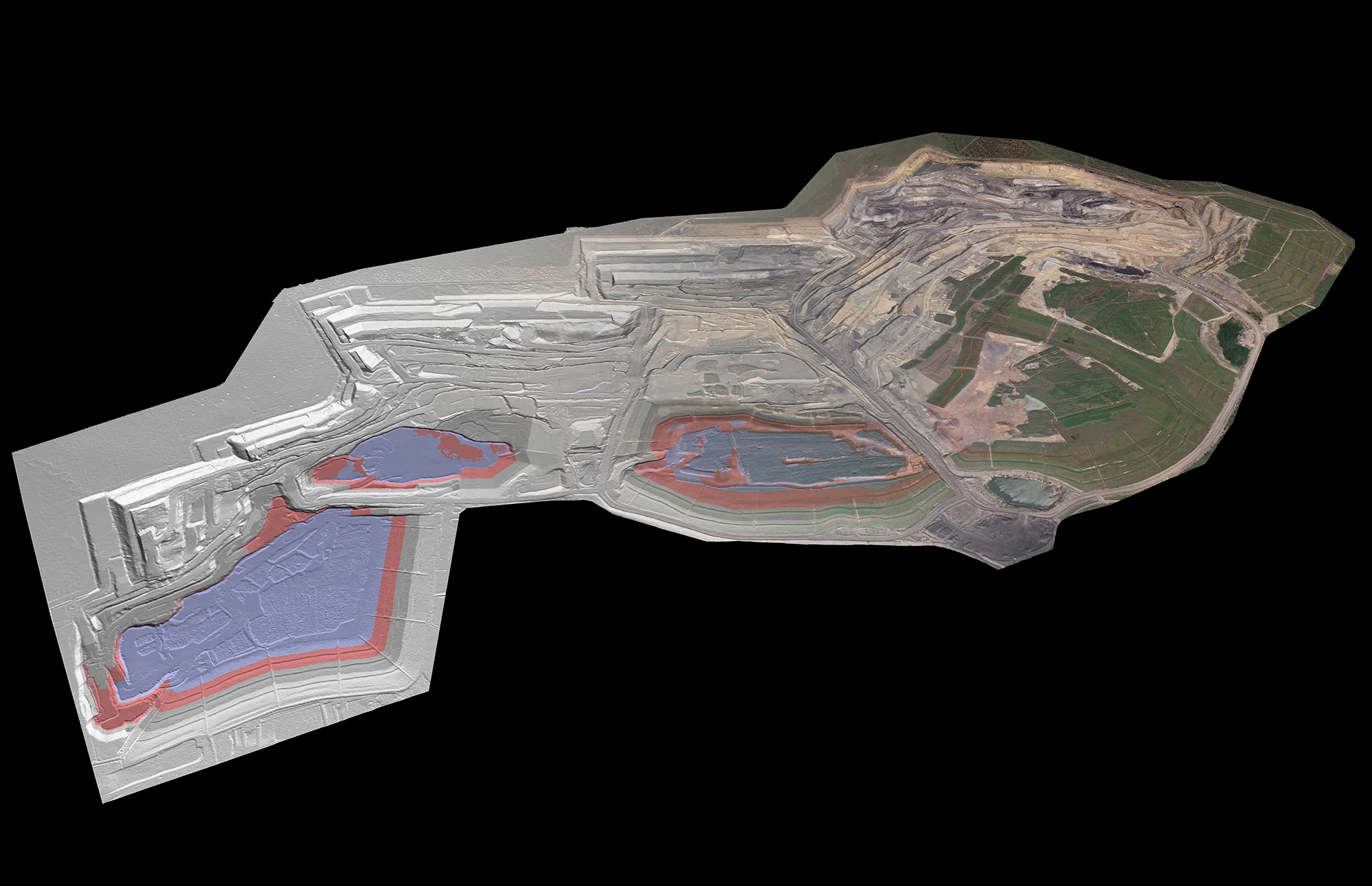
Maptek has launched its GeoSpatial Manager solution, which it said brings simplicity and efficiency to workflows, changing how mining and civil engineering projects handle data from laser scans and drones. GeoSpatial Manager effortlessly connects users with real-time updates for surveyed surfaces.  Its smart visualisation tools and user-friendly interface redefine how you interact with as-built surfaces, enabling seamless collaboration and accessibility…

Read More

Maptek gives sight to underground miners

Australian-based Maptek has launched VisionV2X: a reliable, underground safety detection system aligned with global safety guidelines. “The Maptek proximity awareness system has underground safety as the key objective. It can be fitted to any vehicle across a mixed manufacturer fleet that is commonly deployed in underground mines,” said Maptek CEO Eduardo Coloma. At the heart of VisionV2X is a simple,…

Read More

CEEC adds Maptek to sponsorship roster

The Coalition for Eco Efficient Comminution (CEEC) has taken on its newest sponsor, global software developer and services provider Maptek. The three-year sponsorship agreement is the first for CEEC from a mining design software company. “Maptek coming on board as a CEEC sponsor highlights the huge potential to translate improvement goals around mining footprint and productivity and connect them across…

Read More